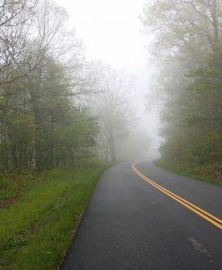
Today's run (milepost 20 to milepost 40) featured cool temperatures, fog, and the longest, steepest downhill I have ever seen.
Day 2 Run
The details of today's run can be found at https://connect.garmin.com/modern/activity/1173918623. I went from Milepost 20 to Milepost 40 even though the running watch measured it as 19.88 miles. I faced two significant uphill sections to start the day, a 3-mile, 1000-ft descent in the second half, and finally another significant climb toward the end. My legs were tired requiring more walking mixed with the uphill running. The disappointment was in that huge descent. A cranky left quad muscle would not let me run that steep of a grade. I had to walk all of it; attempting to run it would have ended #relaywithray with a pulled or torn quad.
The goal today (as every day, but even more so today) was covering 20 miles as healthy as possible and be able to "toe the road" again tomorrow with decent legs. I hope the quad cooperates over time, it was a problem intermittently in training.
Photos
 Again today, fog greatly limited views. Most of the run had less than 300 foot visibility. I guess that's an allegory for life--some days have grand vistas, but some days we plod along unable to really see the great stuff in the distance. For the first 2 hours of running, it was me, fog, trees, asphalt, and a double yellow line.
Finally toward the end of the run, during that steep descent, I got below the cloud layer and could see more stuff.
Again today, we posted photos on http://www.BRPWeather.com/. Click on the link, then zoom into the north end of of the Parkway in the Google Map to see our photos between Whetstone Ridge/Montebello and just north of US Hwy 60. By the way, you can upload your photos at BRPWeather.com also; just click on the Photo link and follow the process--it's quick and easy!
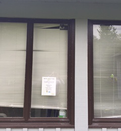
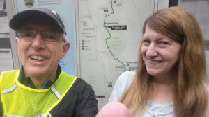
One neat item today for us was to visit the Blue Ridge Parkway Whetstone Ridge/Montebello Maintenance Facility where a BRPWeather.Com web cam and weather station are located. Below are photos of the web cam and Susan who works there--we will not meet a nicer person on our entire journey. She reluctantly agreed to a selfie with this old guy.


Location Information
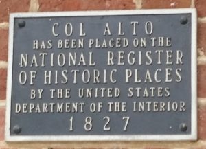
 After the run, our day ended in beautiful Lexington, VA. This is a great small city with two universities (VMI and Washington and Lee), a great downtown commercial and historic district, and complete with horse-carriage rides. We are staying at a great hotel--the Lexington Historic District Hampton Inn which is attached to the historic Col Alto Mansion. We had an awesome dinner at Southern Inn (highly recommended by us) and ice cream at Sweet Things in Downtown Lexington.
Keep up the great momentum! We’re cheering you on each and everyday.
Thanks! And thanks for letting me take your husband for a week.
Don’t feel bad about walking! You may go a little slower, but walking can connect you even more with your surroundings. Take your time and enjoy!