Day 8's run started at Milepost 140, just down from Sweet Auntie's Holler, and ended at Milepost 160 near Floyd, VA. It included lots of rolling hills with just a couple climbs. I took it gingerly.
Day 8 Run
Today's terrain was much less challenging; however, I have an issue with my lower left leg. I'm almost positive it is a muscle strain (or pull or tear) related to the exaggerated banking and road camber on the Parkway. I'm sure Stanley Abbot (original Parkway architect) was the inventor of the NASCAR banked oval! Running on the left side of the road forces me to run much of the time with the road slanted left. Muscles that stabilize us on uneven surfaces are being forced to work much harder than usual. Thus the issue, and there's not much I can do about it. We'll fight through the challenge and hopefully it will get better in time.
So today, in spite of easier terrain, I kept it pretty slow. Here are details on the run... https://connect.garmin.com/modern/activity/1182595615.
I'm keeping updated statistics on the run at the RWR Stats page. 20 miles per day for 8 days; needless to say, I've never done that before!
Photos and Video
The App Ortho Photo of the Day

For the rest of this journey, we'll pick the most interesting of our experiences and share a picture here in the blog.
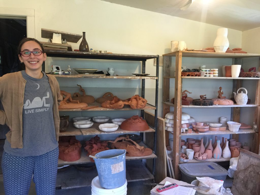
The most interesting story and photo today was pottery. Around Milepost 155, just off the Parkway, Rhonda found a building with a "Pottery" sign on top. She stopped and found plenty of pottery, but no one at home initially. Soon, Gloriann Langva came and took Rhonda around. Gloriann is from New York and has been a potter assitant for 2 years under Richard Hensley and Donna Polsono. Gloriann took Rhonda into her personal studio with both pottery and sculptures. The photo here is of Gloriann with her work. Gloriann is about to leave for Graduate School at the University of Wisconsin. Many thanks to Gloriann for her hospitality.
Photos from today's run have been uploaded to http://www.BRPWeather.com/. From BRPWeather's google map, zoom into the north end of of the Parkway to see our photos between Copper Hill and Floyd. By the way, you can upload photos to BRPWeather.com also; just click on the Photo link and follow the process--it's quick and easy!
The biggest attraction between MP 140 and 160 is Smart View Recreation Area. It's HUGE, with many hiking trails and a large picnic area.
Location Information

So glad to see your post for the day. Sounded like a good day on the Parkway!
Glad you made your trip to Floyd. Was great seeing you and Rhonda. Best of luck on the rest of your journey. We’ll be following your posts.
Hang in there Ray! I am enjoying running the Parkway vicariously. Keep the the posts coming.
I could not resist commenting. Exceptionally well written!